
Drone Flying
Why Choose 4DS Drone Services David Jagger for PIX4D Training

David Jagger – Bringing Decades of Industry Experience to Professional PIX4D Training
Real-World Knowledge Behind Professional Drone Mapping Training
As drone surveying, photogrammetry, digital twins, and geospatial technologies continue to transform industries across the United Kingdom, the importance of practical software training has never been greater.
Behind every successful training programme is not only software knowledge but also real-world operational experience.
At 4DS Drone Services, professional PIX4D training is led by David Jagger, a highly experienced drone survey specialist, business consultant, and commercial drone operator whose career spans more than 30 years across multiple industries.
This combination of commercial experience, surveying knowledge, technology integration, and operational drone work provides trainees with practical skills that extend far beyond learning software menus.
Who Is David Jagger?
David Jagger is the founder of 4DS Drone Services and a recognised UK trainer for PIX4Dmatic. Through both professional drone operations and software training, David supports organisations across construction, infrastructure, environmental management, agriculture, utilities, engineering, property management, and asset inspection sectors.
Prior to establishing 4DS Drone Services, David spent more than three decades working within global manufacturing and technology-focused environments, developing extensive experience in business development, technical consultancy, surveying technologies, GIS systems, photogrammetry, aerial imaging, LiDAR workflows, and digital mapping solutions.
This broad industry background allows him to understand not only how geospatial data is created but also how businesses actually use that information to make decisions.
Why Industry Experience Matters in PIX4D Training
One of the most common challenges within drone mapping is that many operators focus entirely on software processing while overlooking the importance of data capture, survey methodology, accuracy validation, and client deliverables.
David's approach to training is based on the understanding that successful photogrammetry starts long before imagery is imported into PIX4D.
Professional drone mapping requires knowledge of:
- Flight planning
- RTK workflows
- Ground Control Points (GCPs)
- Survey accuracy
- Coordinate systems
- Photogrammetry principles
- Data management
- Client deliverables
- CAD and GIS integration
These are all areas that David regularly applies within commercial projects delivered through 4DS Drone Services.
Because the training is built around real operational workflows, delegates learn how professional surveying projects are completed from initial planning through to final outputs.
Experience Across Multiple Industries
Over the years, David Jagger has worked with organisations operating in a wide range of sectors where accurate geospatial information is critical.
These include:
Construction and Engineering
Supporting construction teams with drone surveys, progress monitoring, orthomosaic generation, topographical mapping, and digital site documentation.
Infrastructure and Asset Management
Delivering drone inspections and geospatial data collection for buildings, facilities, utilities, industrial assets, and confined-space environments.
Agriculture and Environmental Management
Using drone mapping and photogrammetry to support land management, environmental assessments, compliance requirements, and agricultural operations.
Property and Estates
Providing aerial surveys, 3D modelling, roof inspections, and digital asset management solutions for property owners and estate managers.
Surveying and Geospatial Services
Producing high-accuracy deliverables including:
- Orthomosaics
- DSMs
- DTMs
- Point clouds
- Contours
- CAD outputs
- GIS-compatible datasets
This broad industry exposure enables trainees to understand how PIX4D software is applied in real-world commercial environments.
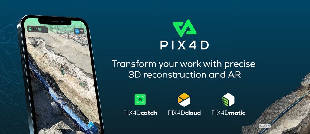
Official PIX4Dmatic Training Expertise
David Jagger is recognised as a PIX4Dmatic trainer through the PIX4D training network, helping organisations and professionals develop practical skills using one of the world's leading photogrammetry platforms.
Training covers:
- PIX4Dmatic workflows
- RTK drone surveying
- Ground Control Point implementation
- Survey accuracy optimisation
- Point cloud generation
- Orthomosaic creation
- Digital terrain modelling
- Volume calculations
- Deliverable generation
Rather than focusing solely on software operation, training is structured around achieving professional-quality outputs.
Learning From Real Commercial Projects
One of the key advantages of training with David Jagger is that the material is based on active commercial drone projects rather than purely academic examples.
Through 4DS Drone Services, projects regularly involve:
- Drone surveys
- Topographical mapping
- Construction monitoring
- Infrastructure inspections
- Agricultural mapping
- Environmental surveys
- Digital twins
- Asset inspections
This allows trainees to learn from genuine project challenges, real client requirements, and practical operational scenarios.
Supporting the Growth of Drone Surveying in the UK
As drone technology continues to advance, organisations increasingly require professionals who understand both data capture and geospatial processing workflows.
David Jagger has become a strong advocate for raising standards within drone surveying by helping operators understand:
- Survey-grade workflows
- Data quality requirements
- Accuracy validation
- Professional deliverables
- Commercial applications of drone mapping
This practical approach helps bridge the gap between drone operation and professional geospatial services.
Why Professionals Choose Training with David Jagger
Professionals attending training through 4DS Drone Services benefit from instruction grounded in:
- Over 30 years of business and technical experience
- Commercial drone surveying operations
- Real-world photogrammetry projects
- GIS and mapping workflows
- Surveying best practices
- PIX4Dmatic expertise
- Industry-specific applications
This combination provides a learning experience that is focused not only on software but also on delivering successful outcomes for clients and projects.
Conclusion
Successful drone mapping requires much more than simply processing imagery.
Professional results depend on understanding:
- Survey planning
- Data capture
- RTK positioning
- Ground Control Points
- Photogrammetry workflows
- Quality assurance
- Client deliverables
With more than three decades of experience across multiple industries and an active role as a PIX4Dmatic trainer and founder of 4DS Drone Services, David Jagger brings practical operational knowledge directly into every training programme.
For organisations seeking professional PIX4D training, drone mapping expertise, and real-world geospatial workflows, David Jagger continues to help businesses develop the skills required to produce accurate, reliable, and commercially valuable survey data across the UK.
Commercial Drone Inspections & Surveys Carried out by 4DS Drone Services

For further information contact us on +44 (0) 7391233647